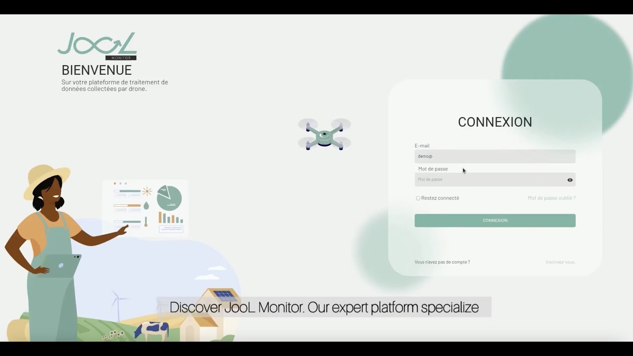
arrow_back Back to home

See your land
in high resolution.

JooL Monitor transforms drone flights into detailed maps, precise measurements and field-ready reports to analyse surfaces, count plants and monitor plot evolution over time.

2 cm
GSD resolution
98%
Count accuracy
500 ha
Per flight mission
What JooL Monitor enables in the field

Precise field intelligence,
measurable and actionable.

grain

Smart counting

Detect, count and locate plants automatically to visualise gaps, densities and variations plot by plot.

map

High-definition orthomosaic

Get ultra-detailed, sharp, measurable aerial maps directly usable by your field teams.

view_in_ar

3D terrain models

Reconstruct terrain relief, volumes and vegetation structure to analyse your farm blocks with greater precision.

task_alt

Visual audit & compliance

Compare actual terrain to declared data, identify discrepancies and document sensitive zones with visual evidence.

history

Time-based monitoring

Compare multiple drone missions to measure crop evolution, detect losses and track changes over time.

download

Ready-to-use exports

Download your deliverables in formats compatible with your GIS tools, reporting systems and operational workflows.

How it works

How JooL Monitor works

From drone flight to field deliverable.

01

Mission preparation

Each flight is prepared according to your plots, operational goals and field constraints.

02

High-precision acquisition

The drone captures full-area coverage to ensure reliable, consistent and detailed field visibility.

03

Intelligent data processing

Images are stitched, modelled and transformed into operational cartographic deliverables.

04

Analysis & rapid delivery

Receive maps, indicators and reports ready for operational and technical teams.

Pricing

Pricing tailored to
field operations.

flight
One-off drone mapping
Drone flights and cartographic deliverables for plantations, audits and field missions.
From 10,000 FCFA
≈ $17
per hectare
east Discover JooL Monitor
grain
Plot counting & analysis
Smart counting, density analysis and anomaly detection across agricultural plots.
On quote
Depending on area & complexity
east Contact us
business
Multi-site & industrial missions
Drone deployments for agro-industrials, institutions, infrastructure projects and large agricultural portfolios.
Custom
Custom pricing
east Contact us
layers
GIS export & advanced deliverables
HD orthomosaics, 3D models, GIS layers and enterprise-ready outputs for your workflows.
Options available
Depending on project needs
east Talk to our team
Ready to get started?

Move from observation to measurable intelligence.

JooL Monitor transforms drone imagery into actionable maps, precision measurements, and field intelligence that help teams make better decisions on the ground.

flight Discover JooL Monitor Talk to our team