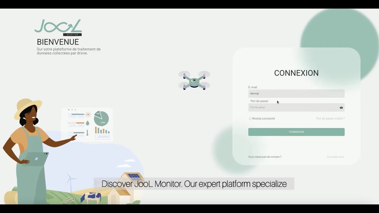
JooL révèle ce que chaque hectare cache : risques, anomalies, potentiel et décisions à prendre grâce à l'IA, l’imagerie satellite et les drones.
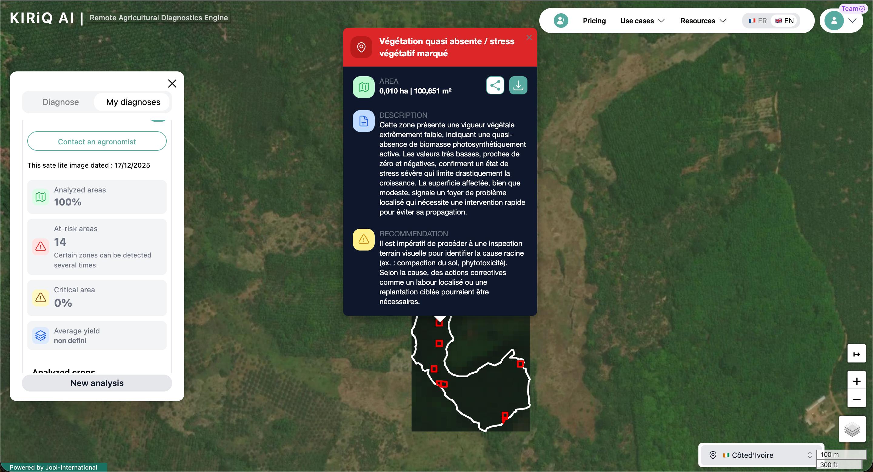
KIRiQ Ai transforms satellite imagery into clear field intelligence: anomalies, risk zones, potential yield impact and recommendations.
You decide before losses become visible in the field.
JooL Monitor transforms drone imagery into actionable field intelligence to count, measure, map and monitor your plots with field-ready detail.
JooL ID structures essential agricultural data: farmers, plots, crops, surfaces, cooperatives and verification statuses, into a reliable, traceable and scalable infrastructure.
Mon Agro by JooL connects JooL diagnostics to a network of agronomists and technicians to support farmers, execute interventions and monitor plots with precision.
The impact of our solutions in the field, in numbers.
From insurers and agro-industrials to cooperatives and public institutions, JooL helps agricultural stakeholders see better, decide faster
and act more effectively in the field.
From satellite image capture to a final actionable report in one hour. Fast, reliable decision-making over a cup of coffee.
KIRiQ Ai, Jool Monitor and Jool ID communicate with each other. A unified view of all your farms.
Our field data collection app works in areas with reduced (or no) connectivity across Côte d'Ivoire and Africa.
Continuous farm monitoring using synchronised satellite, drone and field data.
AI models specifically trained on African tropical crops for maximum accuracy.
A team of agronomic and technical experts available to support you at every step.
Everything you need to know about our AgriTech solutions.
KIRiQ Ai is our large-scale satellite monitoring solution. It allows you to track thousands of hectares simultaneously using satellite imagery and artificial intelligence, with regular update frequency, without requiring field teams to travel. The result: continuous, fast and highly scalable monitoring at a cost 10 to 15 times lower than a drone intervention.
JooL Monitor is our precision aerial mapping service using drones. Our teams of certified pilots travel to the field to capture very high-resolution images and produce detailed plantation maps. This technology delivers a level of precision far superior to satellite and allows a thorough analysis of crop condition, density, gaps, affected zones and specific agronomic issues.
In summary
KIRiQ Ai gives a continental view. JooL Monitor gives a field-level view. Together, they enable farmers, insurers, banks and agribusinesses to make faster, more precise and better-informed decisions.
Our solutions are optimised for oil palm, rubber, cocoa, coffee, maize, bananas, cashew and major food crops.
Our AI models are designed for African tropical crops and can be adapted to other specific crops on request.
KIRiQ Ai delivers near-real-time satellite analyses, subject to image availability and cloud cover.
JooL Monitor reports are typically delivered within 24 to 48 hours after the flight.
Discover how JooL leverages AI, satellite intelligence, drones, and field operations to help agricultural stakeholders make more informed decisions at scale.